Drones or UAVs can be classified in many different ways based on size, range, weight, purpose, and power source, and etc. The most important classification of surveying drones, however, is rotary wing and fixed wing. Although both widely used in photogrammetric surveys, these two types drones have different advantages and drawbacks. According to PrecisionHawk, the fixed wing platform follows the usual airplane design and flies a preprogrammed flight path (think PrecisionHawk and Sensefly). On the other hand, the rotary type, which uses a multi-component propeller system, can move in several directions, think Aeryon Labs and 3D Robotics. Fixed wing UAVs are able to calculate flight plans and capture consistent data across large areas, while rotary UAVs can hover in a single location for some time and be used for thorough inspections.
Our choice of drones are two consumer grade low-cost quadcopters:
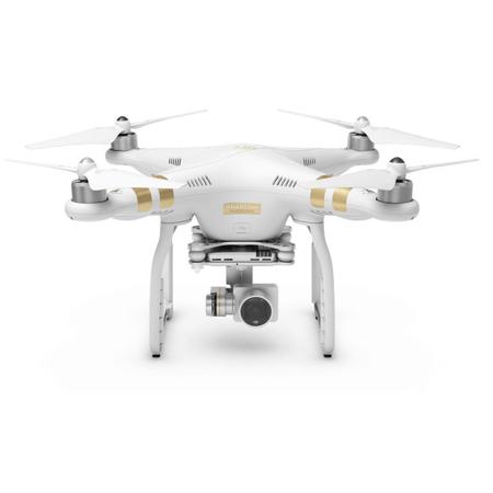
a. DJI Phantom 3 pro (circa $800)
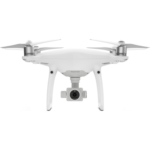
b. DJI Phantom 4 pro (circa $1800)
To learn more about other options, please see the following information we copied from DroneZon https://www.dronezon.com/learn-about-drones-quadcopters/introduction-to-uav-photogrammetry-and-lidar-mapping-basics/
This Mavic Pro is perfect for photogrammetry and Lidar mapping applications. This quadcopter uses the latest IMU, flight control stabilization technology to fly super still along with a 4k stabilized integrated gimbal and camera.
This will create very accurate point clouds and perfect 3D maps stitched together using software from companies such as DroneDeploy or Pix4D.
Waypoint navigation is very important for creating accurate 3D photogrammetry images. The Mavic Pro uses the “Draw Waypoints” for it’s autonomous programmed flight.
With a transmission range of 4.3 miles (7 km) and a flight time up to 27 minutes, you can cover a lot of ground. You can read further on all the DJI Mavic Pro features here.
The Matrice 100 platform has all of DJI’s easy-to-fly technology built in. It includes the flight controller, propulsion system, GPS, DJI Lightbridge, a dedicated remote controller, and a rechargeable battery. It has additional expansion bays allowing you to add components such as cameras, infrared sensors and LiDar scanners used to create complex 3D Maps.
The Matrice 100 has enhanced GPS with allows for highly accurate photogrammetry. The enhanced GPS also allows you to track the Matrice 100’s position in real time, while enabling faster satellite acquisition, more accurate position holding and flight planning.
The Phantom 4 released in Spring 2016 can use the Pix4Dmapper Mesh DJI edition which is mentioned further down this article. This first videos shows you how to create 3D Model using the DJI Phantom 4 and the Photogrammetry mapping Agisoft PhotoScan software.
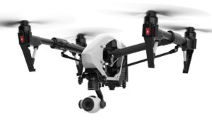
In September 2015, a firmware and software update gave the DJI Inspire 1 and Phantom 3 models waypoint navigation and can now be used for photogrammetry. This next video gives a demonstration of using the Drone Deploy Mapping software to create 3D maps with a DJI Inspire 1, Phantom 3 and Phantom 4 drone.
The best software to use with DJI drones is the Pix4Dmapper Mesh DJI edition. They DJI Phantom 3 and Inspire 1 can also used the Altizure app for photogrammetry. More information on the Pix4DMapper and Altizure for 3d mapping and modelling below.
The Spreading Wings S1000 model can be customized to carry many different types of cameras and sensors including those mentioned above which are ideal for photogrammetry and mapping. In choosing a camera, you need to have a matching gimbal to carry the camera. DJI are world leaders when it comes to drones, gimbal and camera stabilization.
SenseFly eBee Pro Mapping UAV
The eBee mapping UAV is a fixed wing, fully autonomous drone which captures high-resolution aerial photos that you can transform into accurate 2D orthomosaics and 3D models. The eBee can cover up to 12 square kilometers (4.6 square miles) in a single flight, and over smaller areas, flying at lower altitudes, it can acquire images with a GSD of down to 1.5 cm/pixel.
The eBee comes with two software packages: eMotion (flight planning and control) & Postflight Terra 3D (professional photogrammetry).

The 3DR X8-M comes as a full package which includes the quadcopter, the Canon high resolution 12 MP digital camera and also the Pix4DMapper 3rd edition software required for rendering the photos into 3D maps. The 3DR X8-M has GPS, autonomous waypoint navigation, repeatable flight paths and is perfect for precision aerial maps and surveys. The X8-M is one of the easiest UAVs to plan and program autonomous missions and creating 3D photogrammetry maps.
Unfortunately the X8 models are now end of life with 3DR. Their SOLO drone reviewed a little further down is now adaptable for photogrammetry.
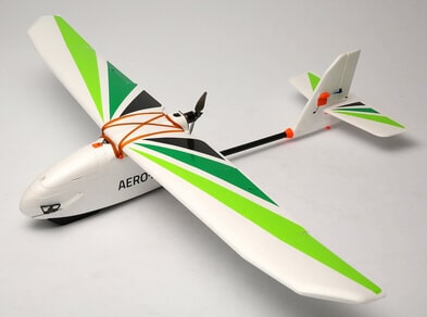 The Aero-M is an all-in-one solution for creating high-resolution visual-spectrum aerial maps. It’s the perfect platform for acquiring highly detailed data for large-scale operations such as farming, construction, conservation, as well as search and rescue and emergency response. the Aero-M has a lightweight and tough foam frame.
The Aero-M package includes a Canon S100 high-resolution 12 MP camera, the powerful Pix4Dmapper LT 3DR Edition software which is used to create highly accurate, georeferenced and orthorectified mosaics.
View the last video below to see how easy it is to plan an autonomous mission with the Aero-M and also to create a 3D maps of a large area.
The 3DR SOLO drone was released in 2015 and designed specifically for the GoPro Hero 4 camera. The SOLO drone can now be used to create 3D Maps using the Pix4Dmapper mesh software. You can read more about this Pix4Dmapper mesh software below.
This year, 2016, 3DR released the Site Scan product. This enables the Solo drone to collect high-quality 2D and 3D geotagged aerial data. It’s available now with the GoPro HERO4 Black camera and later this year with the Sony UMC-R10C.
The price for the 3DR Solo quadcopter with gimbal is as low as USD $378 at the time of writing. However, 3DR have discontinued manufacturing the SOLO drone and will concentrate on their Site Scan and other products.
The Trimble UX5 ensures optimal image quality along with maximum photogrammetric accuracy. The UX5 camera has a large imaging sensor which captures very sharp, color-rich images, even in dark or cloudy conditions. The 24 MP camera and its custom optics give the UX5 the ability to capture data down to 2.0 cm (0.79 in) resolution.
The design of the Trimble UX5 means it can fly in practically all weather conditions.
The Aeryon sUAS is designed for any application that requires survey-grade accuracy orthomosaics, DSMs and point clouds from aerial or oblique imagery – and seamless integration with GIS, CAD, and traditional photogrammetry software. The Aeryon Map Edition includes the Aeryon SkyRanger sUAS, the integrated imaging payload for image capture and Pix4Dmapper software to enable field and office image processing, including integrated tools for 3D output visualization and editing.
You may use an iPad, iPhone, tablet, or a DJI Phantom 4 high luminance display as your viewing device.

DJI Phantom 4 Remote Controller with Built-in Screen
Read more at: http://www.gizbot.com/gadgets/news/dji-phantom-4-advanced-launched-with-high-end-camera-intelligent-features/slider-pf72582-039960.html

Using an iPad as a viewing device (also note the sunhood)
a .extra batteries (one battery can last 25-28 minutes of flight time under ideal conditions)
b. extra charger and power cord (recommend one pair for every two batteries for quick recharging)
c. bigger micro SD cards
d. Controller Monitor Hoods (sun hoods)
e. hard cases

Ground control point (GCP) markers
It is necessary to have some GCPs to achieve accurate results if you are not using professional mapping drones, such as senseFly eBee. To be able to easily identify these GCPs on your aerial photos, you will need to use some markers. If funding permitted, a good option is the smart ground control points, such as the AeroPoints by Propeller Aero (10 for $6000, can be used to obtain accurate results for an area of 120ha). These smart ground control points only only help you mark the GCPS, but also automatically record the accurate location of the GCPs, which will save you a lot of time and energy measuring them with professional surveying equipment. The other low cost option is to purchase some fabric markers or make your own marker with ceramic tiles or other materials. The most important thing is that they all need to have a clearly marked center point. If possible, mark the targets with numbers for easier identification. In terms of the total number of photo targets needed for a project, there is no consensus among researchers as it varies for every project. The usually recommended number is 8 to10 for an area covered by one flight (if using DJI drones), but it is always a good idea to have some extra for final quality check. Sometimes you can take advantage of some "natural" points and use them a supplement to your GCP markers.

AeroPoints

Fabric GCP marker
https://soundwaves.usgs.gov/2016/07/fieldwork.html

Painted GCP marker
https://help.propelleraero.com/hc/en-us/articles/213498677-What-are-ground-control-points-GCPs-
Surveying equipment
Necessary to accurately map the GCPs. The most commonly used surveying equipment include total station and RTK. To use these equipment, usually you will need to have at least one or two known points.

Total Station

RTK
http://www.pobonline.com/articles/97168-mapping-subsurface-utilities-requires-detective-work
for checking the quality of photos in the field and backing up data